GE vs. OAM
Google’s imagery vs. the imagery in OpenAerialMap:
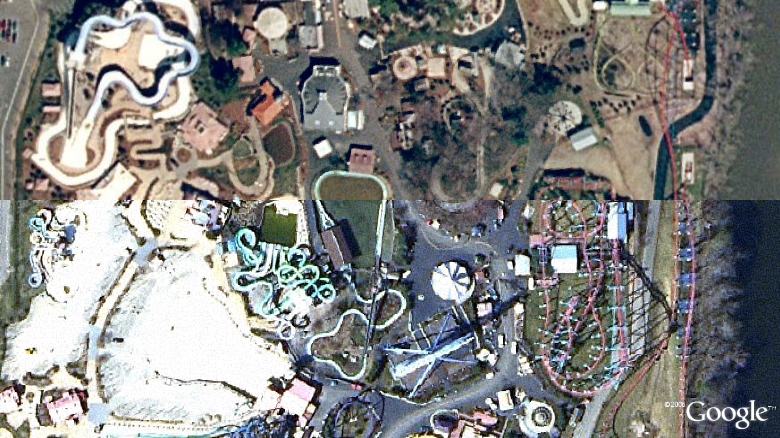
Which one is which?
The answer is probably obvious from the OAM Main Map, once you know where to look…
This is a case where I actually like OAM’s imagery better than GE’s. I’m pretty sure both are sourced from MassGIS, but GE’s is from 2003, and OAM’s is the more recent 2005 imagery.
December 8th, 2007 at 9:54 am
I read your comments on Ramseys blog. What Montana data are y’all placing into OAM? Just the NAIP?
And btw and fyi, not sure why, my virus blocker popped up twice when I came to the comment page on your blog.
OAM looks like a great project. All the best with it.
KoS